• Post Falls Dam

  • Photographed by Tom Holman

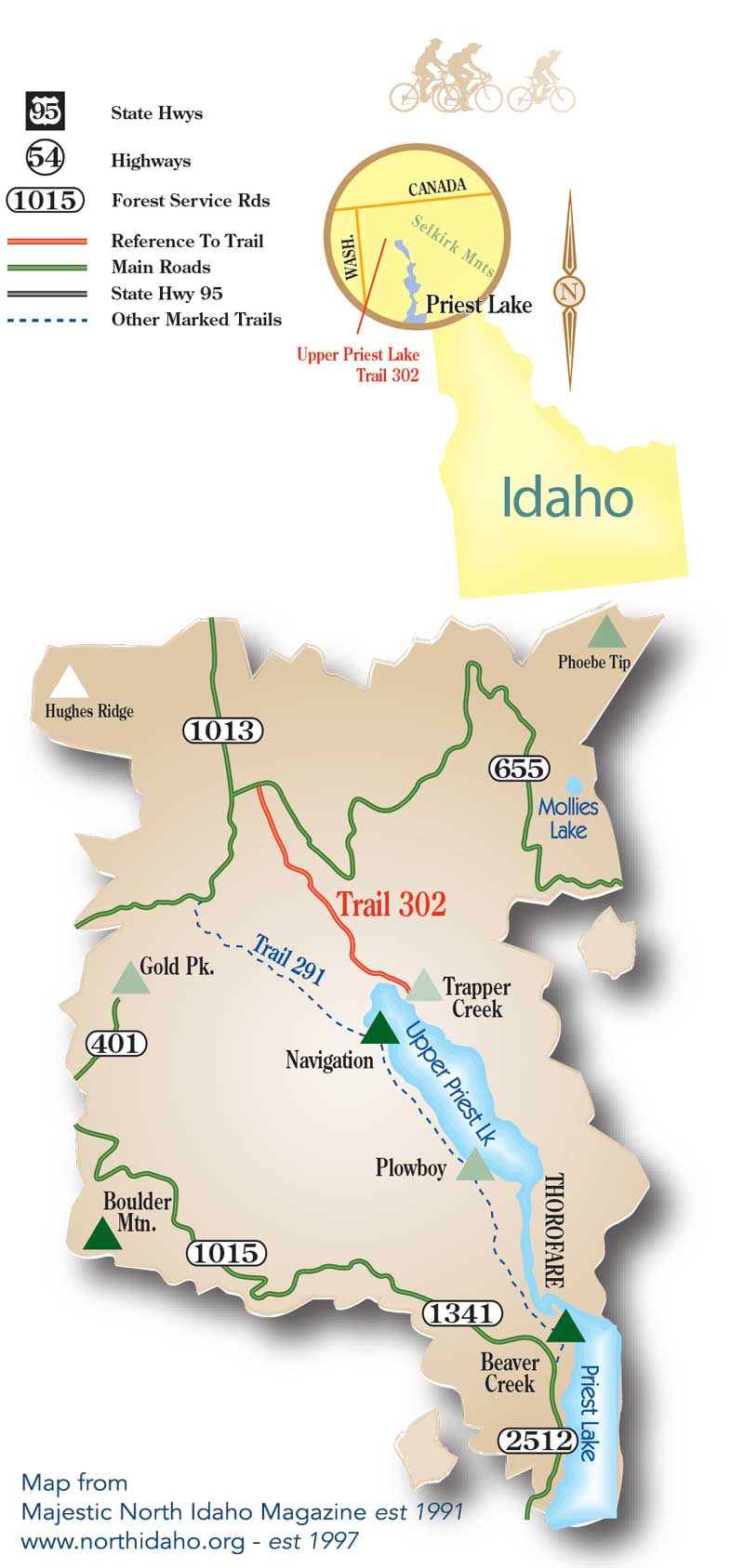
Lookout Mountain (Priest Lake)
Type: Mountain/Rock
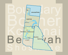
Location: Priest Lake Idaho
Lat/Lon: 48.77300°N / 116.769°W
Activities: Hiking Season: Spring, Summer, Fall, Winter
Elevation: 6727 ft / 2050 m

This trail near Coolin, Idaho that features a great forest setting and is thick with huckleberries during the summer months. Rated as moderate.

Lookout Mountain stands above the north end of Priest Lake, Idaho, directly west of The Lionshead and north of Chimney Rock and Harrison Peak. It sports 2 lookouts on its summit: the original lookout built in 1929, which is on the national historical lookout register, and a newer one built in 1977, which is still used. Although its summit is reached by hiking a trail, this peak, as most of the others in the Selkirks, has an imposing, vertical north face. The trail is primarily used for hiking and is best used from June until October.
A short easy hike for families. The views are some of the best in the area.


Print Email

Upper Priest Lake Trail #302 (Priest Lake)
LENGTH: 5.0 miles (one way)
ENDURANCE LEVEL: moderate
SKILL LEVEL: intermediate
ELEVATION: 2630’ trail beginning
SEASON: late June-October

Upper Priest Lake Trail 302

The route to the Trail 302 trailhead is via USFS Road 302 (an extension of State Highway 57) from Nordman. Travel 21 miles north on USFS Road 302 and 1013 over Granite Pass to USFS Road 655. Turn right onto Road 655 and proceed for approximately 1/2 mile. Trailhead is located on Road 655 and ends at Trapper Campground on the east side of Upper Priest Lake. The trailhead will be on your right and the vehicle parking area to your left, across from the trailhead.

Upper Priest Lake Trail 302 is a pleasant, easy hike that traverses a predominately Douglas Fir forest for the first few miles. The trail then drops into an area of old growth cedar as it approaches the north end of Upper Priest Lake.

The trail crosses Ruby Creek as well as other smaller unnamed creeks and eventually follows the east shoreline of Upper Priest Lake to Trapper Campground.

The first four miles of the trail are in timber cover until the lake is reached where it then opens up and follows the lake shore until reaching Trapper Creek Campground. The tread of the trail is in good shape with the exception of several low lying wet areas. The trail passes by an old mine shaft and also Coolin’s cabin, and early hunting stands perched high in the ancient cedars.


Print Email

Beach Trail #48 (Priest Lake)
LENGTH: 6.0 miles (one way)
ENDURANCE LEVEL: easy
SKILL LEVEL: beginner
RESTRICTIONS: Open to foot traffic only

BEACH TRAIL #48

This trail is an easy hike that follows the west shoreline and passes in front of many leased cabins. The 6-mile trail leaves from Outlet Bay Campground, passes through Osprey and Luby Bay Campgrounds, the Priest Lake Museum and Hill’s Resort and terminates at the Kalispell Bay Boat Launch. The trail crosses the Lakeshore Road # 237 twice just south of Hill’s Resort so use caution when crossing the road.

Directions

North Trailhead Access

Take Highway 57 to Kalispell Bay Road go right towards Priest Lake Marina.  Go approximately 1 mile then go right towards Priest Lake Marina and the Kalispell Bay Boat Launch.  Continue past the marina on Lakeshore Road to the Kalispell Bay boat launch. Trail access is located at the south end of the boat launch parking area.

South Trailhead Access

To access the south end of the trail, turn off Highway 57 onto the Outlet Bay Road (mile post 26).  Drive approximately 1/2-mile and turn left onto the Lakeshore Road.  Drive another 1/2-mile and turn left across from the Outlet Bay Campground into the Woodrat Trail parking; head down to the beach in the campground and you will find the trail.  This trail is open to foot traffic only.


Print Email

Reeder Bay Trail #365 (Priest Lake)
LENGTH: 4.2 miles (one way)
SKILL LEVEL: Intermediate
RESTRICTIONS: Closed to ATVs

REEDER BAY TRAIL #365

Many scenic views of the lake are available along this trail that is approx. 4.5 miles long.  It crosses an old ski hill on the Southern end, continues through private land for about 1 mile and proceeds north another 3 miles terminating at Elkins Resort on Priest Lake.

Directions:

Southern Trail Access:

Take Hwy 57 to the Kalispell Bay road go East approx 2 miles to the Kalispel day use area and park.  The trailhead is located at a locked gate across the road from the Kalispell Day-Use area, approx 1 mile beyond the Community Church. From the trailhead, follow the road behind the gate for approximately 1 mile until you see the Lakeview Trail #365 sign to the right.

Northern Trail Access:

The North trailhead is located at Elkins on Priest Lake, near the lodge. Cross the footbridge that spans Reeder Creek and follow the trail from that point. The length of the trail is 4 ½ miles. This is a multiple use trail that includes foot, mountain bike, motorized vehicles and horse traffic.

This trail is an ideal day's trip for parties with two vehicles who can leave a vehicle at either end of the trail. Tread is narrow & steep in places.


Print Email