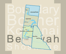


Continental Creek Trail #28
LENGTH: 2.3 miles (one way)
SKILL LEVEL: Intermediate to Difficult
SEASON: Late June to October
Restrictions: Closed to ATVs.
Continental Creek Trail #28
This is a very scenic trail providing a strenuous workout with its many switchbacks down from Rd. #1013 through an old growth cedar stand to the river bottom. Huckleberries, thimbleberries, devils club and ferns grow thick along the trail.
Once to the river, the trail leads to an open flat area which offers an excellent camping spot. The trail then crosses a fork of the Upper Priest River and follows it to the falls near the Canadian Border.
A short section of the trail near the falls, which climbs above the river, is steep and lacks tread. This may cause difficulty for some to hike the full distance to the falls. Use caution.
Directions:
North on Hwy 57, Hwy 57 turns into graveled Forest Service Rd. #302, approx. 4 miles past Nordman. Travel north on Rd. #302 approx. 11 miles until it turns into Rd. #1013 at the Granite Pass junction. Continue north approx. 25 miles. Trailhead is near the end of road on your left and just before the locked gate. Trail ends up at Upper Priest River Falls, also known as the American Falls. Road past 308 trialhead not recommended to stock trailers due to rough road and tight switchbacks.
Tags: hiking trail